MV-KO&G-OCAA
Mines
The following map and photos cover coal mining in Sebastian County, Arkansas
 |
Contributed by John Dill |
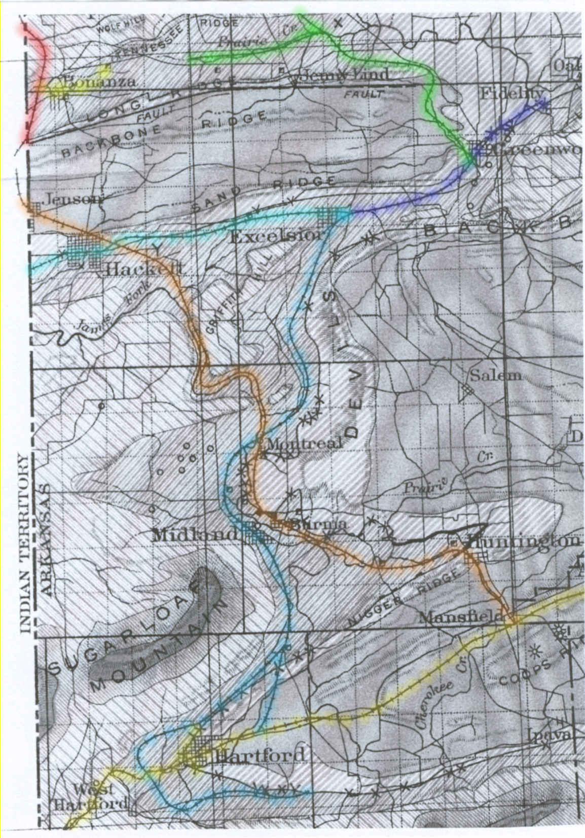
This is adapted from a 1906 USGS map which accompanied a report on local area coal mining. I have colored coded the railroads which are otherwise very difficult to distinguish from other map features. Larger Version (1) Red (upper left), Frisco main line from Fort Smith south to Paris, TX. (2) Yellow (upper left, Bonanza), approximate location of Missouri and Louisiana tracks at this time (not shown on this map). M&L (owned by Central Coal & Coke Co.) also had trackage rights over the Frisco mainline to the KCS at Poteau, OK and over the Mansfield Branch of the Frisco to a coal slack washer at Doubleday, south of Hackett. (3) Brown (Jenson - Hackett - Montreal - Midland - Hackett - Mansfield), Mansfield Branch of the Frisco. For a time the Rock Island also operated passenger service into Fort Smith from its main line at Mansfield over this branch by agreement with the Frisco. (4) Green (upper right), Greenwood Branch of the Iron Mt.(Missouri Pacific Sys.), including a coal spur which ran west toward Bonanza and serviced Western Coal and Mining Company's Mine 17 and Mine 18. Western Coal was a subsidiary of the Missouri Pacific System and mostly provided locomotive coal for the parent company. (5) Light Blue (Hackett - Excelsior), Midland Valley R.R. main line running west from mile post 0 at Excelsior, Arkansas. (6) Dark Blue (Excelsior - Greenwood - Fidelity), Greenwood Branch of the Midland Valley. (7) Medium Blue (Excelsior - Montreal - Midland - Hartford), Hartford Branch of the Midland Valley. (8) Yellow (lower, Hartford - Mansfield), Rock Island Railroad. |
 |
Louis A. Marre Collection |
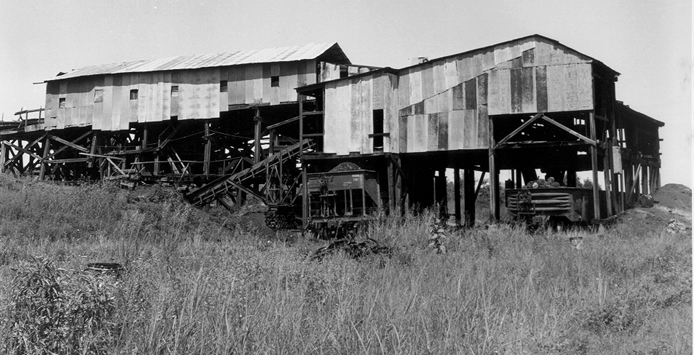
| This is a 1960 view of a mine east of Hackett along the line to Greenwood. The mine was set up for empty cars to be uncoupled on an elected track on the east end of the tipple. Cars were then allowed to roll by gravity to which ever track needed. |
 |
Contributed by John Dill |
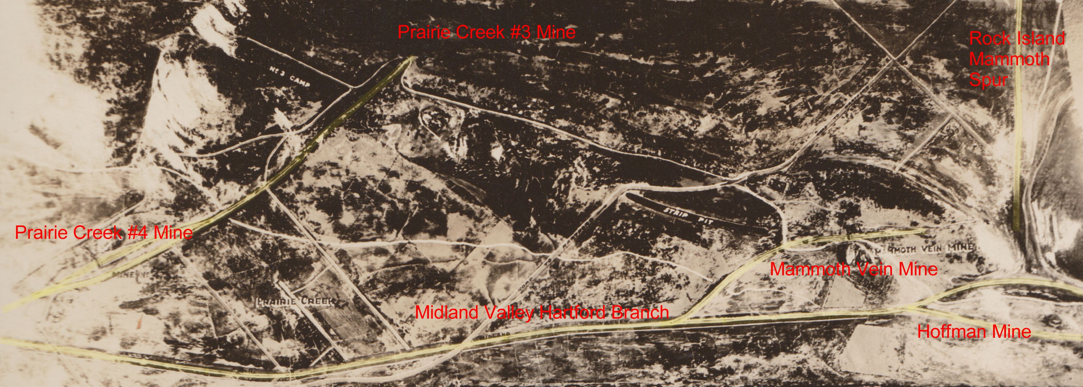
This "relief map" was submitted as evidence in one of the many court cases resulting from the 1914 Bache mine riots. It shows a small area of the MV Hartford Branch. The map helps show just how rough the terrain was. The railroads had numerous fills and trestles and still had steep grades on the mine spurs. The map was made after 1915 and before 1923, perhaps from an aerial photo?? It gives a little bit of insight into just what conditions were like in one of the coal mine areas shown on the 1911 MV ETT. Larger Version The "relief map" showing mines PC No.4, Mammoth Vein, and Hoffman was created by H.O. Lewis, a mining engineer for Bache-Denman Company. It was probably made just for use as evidence in one of the lawsuits after the 1914 mine riots. The scale is said to be vertical - one inch = 30 feet; horizontal one inch = 100 feet. On the 1911 MV timetable, the mines are: Prairie Creek No. 4 became Central Coal & Coke No. 11 in 1915. Everything had to be rebuilt after the original Prairie Creek No 4 was burned during the mine riots and I believe the tracks layout may have been substantially altered at the time? To see what this mine looked like after 1915. |
 |
Contributed by John Dill |
This is a photo, taken in late 1913 or early 1914, showing the "Rock Island tipple" of Mammoth Vein Mine. You can get a little bit of a feel for the terrain in the area. The tracks represent the end of the Mammoth Spur of the Rock Island. If you look carefully at the extreme left (back) of the photo you can see the fill carrying the Hartford Branch of the MV (Hartford is to the left in the photo - which was taken looking west). I thought it was interesting that one of the coal cars (on right) is a Frisco. In addition to the Rock Island and Midland Valley, Bache also had at least one major Sebastian County mine on the Mansfield Branch of the Frisco at this time. Because he used three different carriers he, to a limited extent, had the ability to play one railroad against the other... something he apparently did frequently. |
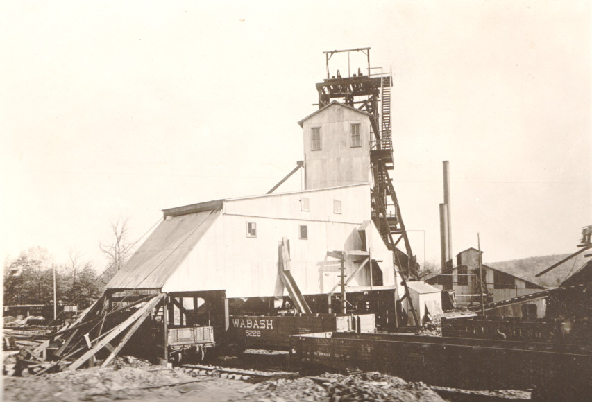 |
Contributed by John Dill |
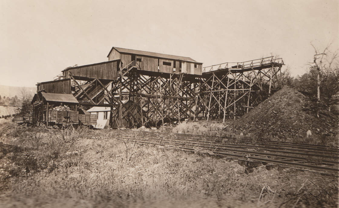
| This is Prairie Creek No. 4 Mine, in 1913, on the Midland Valley Hartford (Sebastian County, Arkansas) Branch. This mine belonged to the Midland Valley interests although it was actually owned under a different corporate name and at this time was leased to the Bache interests. Bache seems to have somewhat specialized in providing "smokeless" passenger coal, much of which went to railroads in Texas and further west. After this mine was burned down in the riots of 1914 the property was leased to Central Coal & Coke Company and the mine rebuilt as CC&C No. 11. The mine riots marked the beginning of the end for the railroad fuel supply segment of the local coal industry. Within 10 years the percentage of Sebastian County coal used by the four largest, local railroads (Iron Mountain/MoPac; Frisco; Rock Island and the Midland Valley) had fallen to almost nothing as these railroads either made an early switch to oil firing or switched their reliance to cheaper, more reliable coal supplies from other areas of the country. |
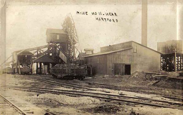 |
Contributed by Jack James |
After the 1914 riots Prairie Creek Mine No. 4 was rebuilt as Central Coal & Coke Mine No. 11. The mine operated as No. 11 from 1915 until December 1920 when it was closed for good." |
 |
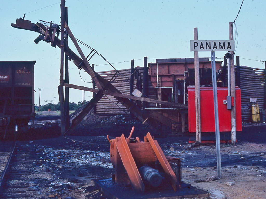 |
| This coal loading tipple was located on the west side of the KCS/MV junction in Panama, OK in June 1975. |
This site is maintained by the Arkansas Boston Mountains Chapter of the National Railway Historical Society located in Springdale, Arkansas


Home of THE ARKANSAS SCRAMBLER
For questions, email arkyrail at outlook.com